
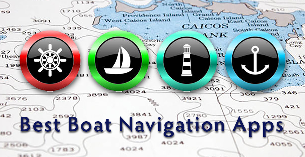
Modern Boating With The Best Boat Navigation App Technology
In today’s modern nautical world, technology plays a starring role. Gone are the days of blurry paper charts and frantic compass checks. Today, boaters navigate with a trusty smartphone held firmly in hand, a portal to a universe of digital charts, real-time weather updates, and invaluable safety features. And while there’s no single “best boat navigation app,” a few contenders stand out for their intuitive interfaces, comprehensive features, and passionate user communities.
Apps like Navionics and iMarine offer detailed offline maps, integrated tide and current data, and real-time hazard alerts. Features like anchor watch and route planning turn even novice skippers into confident navigators. But technology isn’t just about convenience; it’s about safety. Man overboard functions, distress signaling capabilities, and automatic collision avoidance systems make the water a safer place for everyone.
With today’s advanced technology, boat navigation apps are a more mobile option to fixed chartplotters.
Of course, relying solely on apps isn’t a wise course. Understanding basic navigation principles, learning to read paper charts, and maintaining essential boat safety equipment are still crucial. But the best boat navigation app, used responsibly, can be an invaluable addition to any boater’s toolkit. They democratize navigation, making it accessible to a wider audience and encouraging more people to experience the joys of the open water.
So, whether you’re a seasoned captain or a newbie casting off for the first time, embrace the digital wave. Research the best boat navigation app for your needs, invest in quality safety equipment, and get ready to chart your own course. Just remember, the best boat navigation app is the one you use responsibly and in conjunction with traditional skills. So, raise the sails, fire up the engine, and let the digital tides guide you – the nautical adventure awaits!
This site uses affiliate links which may earn a commission at no additional cost to you

The Importance Of Choosing The Best Boat Navigation App
In today’s digital age, there’s an app for everything. From ordering food to booking a vacation, apps have become an essential part of our daily lives. But with so many options to choose from, it can be overwhelming to find the right one.
Newbies need intuitive interfaces and clear visuals, while seasoned captains might crave advanced route planning and detailed charts. Are you a weekend wanderer or a bluewater warrior? Do you fish the inshore flats or navigate treacherous reefs? The “best” app caters to your specific journey.
Below are the top 10 best boat navigation app for every level boater.
What Is The Best Boat Navigation App Available?
1. Navionics Boat Navigation App

The Navionics Boating app stands out as a versatile and user-friendly navigation tool tailored for boaters, sailors, and anglers. Offering a suite of features, this app aims to enhance the overall boating experience through detailed charts, advanced navigation tools, and real-time data.
Whether you’re a seasoned skipper or a curious first-timer, Navionics has the tools to make your time on the water safer, smoother, and more enjoyable.
Key Features
High-Quality Nautical Charts: Navionics provides access to detailed and accurate nautical charts covering coastal and inland waters. These charts are regularly updated to ensure the latest navigational information.
Advanced Navigation Tools: Boaters can plan routes, mark waypoints, and navigate in real time using the app’s advanced tools. The intuitive interface makes it easy for users to customize routes based on their preferences.
SonarChart™ Live: The innovative SonarChart Live feature allows users to contribute to the creation of highly detailed, real-time maps by recording and uploading sonar logs. This collaborative approach helps improve the accuracy of navigational charts.
Community Edits: Users can actively participate in improving the accuracy of charts by submitting local information and edits. This community-driven model ensures that the charts stay current and relevant.
Dock-to-Dock Autorouting: Simplifying route planning, the Dock-to-Dock Autorouting feature generates suggested routes based on the user’s boat dimensions and navigation preferences. This can save time and effort in planning and executing journeys.
Weather and Tides: Stay informed about current weather conditions and tide information directly within the app. This feature allows boaters to make informed decisions about when to embark on their journeys.
Fish Mode: Anglers benefit from the Fish Mode feature, which provides bathymetric contour detail, helping identify potential fishing hotspots. This feature is designed to enhance the fishing experience.
Augmented Reality (AR) View: The AR View feature overlays key navigation information on the device’s camera view. This augmented reality experience enhances situational awareness, making it easier for boaters to navigate safely.
Cross-Platform Sync: Navionics enables users to sync their data and charts seamlessly across multiple devices. Whether planning routes on a tablet or navigating with a smartphone, users can access their information effortlessly.
ActiveCaptain Community Integration: The integration with the ActiveCaptain community provides access to a wealth of user-generated content, including reviews and information about marinas, anchorages, and points of interest.
Navionics Boating App - Pros, Cons, and Best Suited For
Pros:
- Detailed and comprehensive charts: Navionics offers high-resolution vector charts covering oceans, lakes, and rivers worldwide, including official NOAA charts and its own SonarChart™ technology for detailed depth information.
- Advanced features: Route planning with Auto Guidance+, real-time weather, tides and currents, hazard alerts, plotter sync, sharing and social features, and offline functionality.
- Intuitive interface: Easy to use and navigate, even for beginners.
- Active community: Community edits and ActiveCaptain® provide valuable local knowledge and updates.
- Safety focus: Hazard alerts, anchor watch, distress signaling, and collision avoidance features enhance safety.
Cons:
- Subscription-based: Requires a subscription for most features, with varying levels depending on your needs.
- Battery drain: Continuous GPS and data usage can drain phone battery quickly.
- Learning curve: Advanced features might require some effort to learn for beginners.
- Over-reliance on technology: It’s important not to solely rely on the app and maintain traditional navigation skills.
Best for:
- Boat owners and frequent boaters: The subscription costs make it more suitable for those who spend significant time on the water.
- Boat enthusiasts of all levels: Beginner-friendly features with room to grow into advanced functionalities.
- Cruisers, fishermen, and divers: Offers specific features catering to different boating activities.
- Tech-savvy boaters: Those who appreciate the extensive features and integration with technology.
Navionics Boating App - Pricing and Subscriptions
Free Version:
- Limited functionality, offering basic navigation with nautical charts and GPS positioning.
- No route planning, weather data, tides and currents information, or hazard alerts.
- Cannot download charts for offline use.
Subscription Versions:
Varying prices depending on the level of coverage and features you need. Here are some examples:
- U.S. & Canada: $24.99 for 1 year, $49.99 for 2 years.
- Mediterranean & Black Sea: €49.99 for 1 year, €89.99 for 2 years.
- World Coverage: $59.99 for 1 year, $99.99 for 2 years.
- Multiple features included: Advanced route planning with Autorouting™, real-time weather and tides data, hazard alerts, SonarChart™ technology for detailed depth information, Community Edits from other boaters, offline chart downloads, and more.
Additional Factors to Consider:
- Trial option: Navionics offers a free 14-day trial of the premium features so you can test the app before committing to a subscription.
- Different tiers: The subscription price varies depending on the region and features you need. Choose the option that best suits your boating areas and activities.
- Family Plans: Navionics also offers family plans that allow you to share the subscription with other boaters in your household at a discounted rate.
Overall, the free version of the Navionics Boating App is a good starting point for beginners, but its limited features might not be sufficient for experienced boaters or those who want to navigate safely in challenging conditions. For most boaters, the subscription version offers significant value with its comprehensive features and enhanced safety tools.

2. C-Map Embark Boating Navigation App

C-MAP Boating App sails alongside seasoned veterans and curious newbies alike, offering high-quality nautical charts, intuitive navigation tools, and essential safety features for a stress-free journey across any waterway.
Whether you’re a captain carving through open ocean or a recreational boater exploring local coves, C-MAP has the digital compass to guide you confidently.
C-MAP Boating App strikes a balance between powerful features and user-friendly design, making it suitable for boaters of all experience levels. Its focus on accuracy, safety, and intuitive navigation tools makes it a reliable companion for any watery adventure.
Key Features
High-Quality Nautical Charts: Navionics provides access to detailed and accurate nautical charts covering coastal and inland waters. These charts are regularly updated to ensure the latest navigational information.
Advanced Navigation Tools: Boaters can plan routes, mark waypoints, and navigate in real time using the app’s advanced tools. The intuitive interface makes it easy for users to customize routes based on their preferences.
SonarChart™ Live: The innovative SonarChart Live feature allows users to contribute to the creation of highly detailed, real-time maps by recording and uploading sonar logs. This collaborative approach helps improve the accuracy of navigational charts.
Community Edits: Users can actively participate in improving the accuracy of charts by submitting local information and edits. This community-driven model ensures that the charts stay current and relevant.
Dock-to-Dock Autorouting: Simplifying route planning, the Dock-to-Dock Autorouting feature generates suggested routes based on the user’s boat dimensions and navigation preferences. This can save time and effort in planning and executing journeys.
Weather and Tides: Stay informed about current weather conditions and tide information directly within the app. This feature allows boaters to make informed decisions about when to embark on their journeys.
Fish Mode: Anglers benefit from the Fish Mode feature, which provides bathymetric contour detail, helping identify potential fishing hotspots. This feature is designed to enhance the fishing experience.
Augmented Reality (AR) View: The AR View feature overlays key navigation information on the device’s camera view. This augmented reality experience enhances situational awareness, making it easier for boaters to navigate safely.
Cross-Platform Sync: Navionics enables users to sync their data and charts seamlessly across multiple devices. Whether planning routes on a tablet or navigating with a smartphone, users can access their information effortlessly.
ActiveCaptain Community Integration: The integration with the ActiveCaptain community provides access to a wealth of user-generated content, including reviews and information about marinas, anchorages, and points of interest.
C-Map Boating App - Pros, Cons, and Best Suited For
Pros:
- Highly accurate and detailed charts: C-MAP charts are praised for their precision and clarity, featuring official hydrographic data for reliable navigation.
- Offline functionality: Download charts for your chosen region and enjoy uninterrupted navigation even in areas with limited internet connectivity.
- Intuitive interface: The app is user-friendly and easy to navigate, making it suitable for boaters of all experience levels.
- Comprehensive safety features: Real-time weather data, tide and current information, hazard alerts, and Autorouting™ contribute to safe and informed navigation.
- Points of interest and social features: Discover hidden gems, share your experiences, and connect with fellow boaters through integrated features.
- Competitive subscription pricing: Compared to some competitors, C-MAP offers affordable subscription options for different feature sets.
Cons:
- Limited free features: The basic free version has minimal functionality, with most advanced features requiring a paid subscription.
- Battery drain: Continuous GPS and data usage can quickly drain your phone’s battery, so a portable charger is recommended.
- Chart coverage might not be global: Depending on your needs, you might have to purchase additional charts for specific regions.
- Fewer advanced features compared to some competitors: For highly demanding users, apps like iNavX or iSailor might offer more sophisticated functionalities.
- Lack of certain features: C-MAP currently lacks features like satellite imagery overlays and collision avoidance systems available in some competitor apps.
Best for:
- Boat owners and frequent boaters: C-MAP offers subscription options with varying features depending on your needs.
- Boat enthusiasts seeking accuracy and clarity: C-MAP charts are renowned for their detailed and precise representation of waterways.
- Cruisers, fishermen, and divers: C-MAP provides features tailored to specific boating activities, including depth details for fishermen and anchor watch for divers.
- Value-conscious boaters: Compared to some competitors, C-MAP offers competitive subscription pricing.
C-Map Boating App - Pricing and Subscriptions
C-Map navigation app offers both a free and subscription version with varying features and functionalities. Here’s a breakdown:
Free Version:
- Basic navigation with limited nautical charts covering mostly major coastlines and inland waterways.
- GPS positioning and ability to view your location on the chart.
- Basic weather data, but detailed forecasts and real-time updates require a subscription.
- Limited offline functionality – download one chart for offline use.
- No advanced features like Autorouting™, SonarChart™, hazard alerts, route planning beyond basic lines, or social features.
Subscription Versions:
Multiple tiers with varying prices depending on desired features and chart coverage. Some examples:
- USA Coastal Charts: $19.99 per year, basic features and US coastal charts.
- USA Marine Charts: $21.99 per year, adds more detailed US charts and fishing points.
- USA & Canada: $29.99 per year, unlocks all US and Canadian charts with advanced features.
- Comprehensive features in paid versions: Advanced route planning with Autorouting™, detailed real-time weather forecasts, tide and current information, hazard alerts, offline chart downloads for multiple regions, SonarChart™ depth details, Points of Interest database, AIS traffic information (in some regions), social features, and integration with compatible chartplotters.
Additional Factors to Consider:
- Free trial: i-Boating offers a free 7-day trial of the premium features to let you experience the full potential before subscribing.
- No Family Plans: Currently, i-Boating doesn’t offer family plans to share subscriptions like Navionics does.
Choosing the Right Version:
For casual boaters primarily interested in basic navigation and limited area exploration, the free version might suffice. However, for those who frequently venture out, desire advanced features, or navigate more complex waters, the premium versions offer significant value and enhanced safety.
Ultimately, the choice depends on your individual needs and boating style. Weigh the features you find most important against the subscription costs to determine which i-Boating navigation app version best suits your aquatic adventures.
3. i-Boating Navigation App

Key Features
Offline Charts: Download nautical charts for oceans, bays, and inland waterways for offline use.
Route Planning: Plan your journey with waypoints, routes, and automatic course calculation considering tides, currents, and draft constraints.
Auto-Routing: Get turn-by-turn guidance with suggested routes based on your destination and preferences.
GPS Tracking: See your real-time position, track course, and record your journey.
Waypoints: Mark important locations for easy reference and navigation.
Anchor Watch: Set an alarm to be notified if your boat drifts from its anchored position.
Real-Time Weather: Access up-to-date weather forecasts with animated wind and wave displays.
Tide Predictions: Plan your navigation with accurate tide predictions for your location.
Marine AIS Integration: Track nearby vessels equipped with AIS for enhanced situational awareness.
Man Overboard (MOB) Function: Quickly drop a waypoint and calculate the distance to a person overboard.
Search and Rescue (SAR) Information: Access emergency contact information and distress signals.
Fishing Tools: Find fishing spots, depth contours, and marine structures for successful fishing trips.
Points of Interest (POIs): Discover marinas, restaurants, fuel stations, and other amenities near your location.
Community Updates: Share and access information about hazards, anchorages, and other useful details from other boaters.
Voice Guidance: Follow turn-by-turn instructions and safety alerts through clear and concise voice prompts.
Customization: Choose from different map views, adjust chart details, and personalize your navigation experience.
Offline Support: Download additional features like Fishing Maps and Nautical Almanacs for offline use.
i-Boating App - Pros, Cons, and Best Suited For
Pros:
- User-friendly interface: i-Boating is known for its clean and intuitive interface, making it easy to navigate even for tech-averse users.
- Affordable pricing: The app offers a free basic version with limited features, while paid subscriptions provide access to more advanced functionalities and chart regions.
- Voice guidance: The hands-free voice prompts are a valuable feature for any boater, improving safety and convenience.
- Offline charts: The ability to download charts for offline use ensures you’re never caught off guard by a lack of signal.
- Extensive chart coverage: While not as comprehensive as some high-end competitors, i-Boating’s chart library covers a wide range of oceans, bays, and inland waterways.
- Real-time weather and tides: Stay informed with up-to-date weather forecasts and tide predictions displayed directly on the chart.
- Additional features: i-Boating offers a variety of features to enhance your boating experience, including fishing spots, anchor watch, AIS integration, and community updates
Cons:
- Fewer advanced features: For professional navigators or those tackling complex routes, i-Boating may lack some of the sophisticated tools found in other apps.
- Chart coverage not as extensive as some competitors: While impressive, i-Boating’s chart library may not offer the same level of detail or coverage as some high-end navigation apps.
- Limited customization options: Compared to some apps, i-Boating offers fewer options for customizing the map display and navigation experience.
- Subscription required for full functionality: The free version has limited features, so you’ll need to upgrade to a paid subscription to access everything the app offers.
Best for:
- Casual boaters and weekend warriors: Its user-friendly interface and affordable pricing make it perfect for those who enjoy recreational boating on familiar waters.
- Anglers and fishing enthusiasts: The fishing tools and depth contours are valuable resources for finding hotspots and navigating safely around underwater structures.
- Boaters who prioritize simplicity and affordability: If you’re looking for a reliable and easy-to-use navigation app without needing the most advanced features, i-Boating is a good option.
i-Boating App - Pricing and Subscriptions
i-Boating navigation app offers both a free and subscription version with varying features and functionalities. Here’s a breakdown:
Free Version:
- Basic navigation with limited nautical charts covering mostly major coastlines and inland waterways.
- GPS positioning and ability to view your location on the chart.
- Basic weather data, but detailed forecasts and real-time updates require a subscription.
- Limited offline functionality – download one chart for offline use.
- No advanced features like Autorouting™, SonarChart™, hazard alerts, route planning beyond basic lines, or social features.
Subscription Versions:
Multiple tiers with varying prices depending on desired features and chart coverage. Some examples:
- USA Coastal Charts: $19.99 per year, basic features and US coastal charts.
- USA Marine Charts: $21.99 per year, adds more detailed US charts and fishing points.
- USA & Canada: $29.99 per year, unlocks all US and Canadian charts with advanced features.
- Comprehensive features in paid versions: Advanced route planning with Autorouting™, detailed real-time weather forecasts, tide and current information, hazard alerts, offline chart downloads for multiple regions, SonarChart™ depth details, Points of Interest database, AIS traffic information (in some regions), social features, and integration with compatible chartplotters.
Additional Factors to Consider:
- Free trial: i-Boating offers a free 7-day trial of the premium features to let you experience the full potential before subscribing.
- No Family Plans: Currently, i-Boating doesn’t offer family plans to share subscriptions like Navionics does.
Choosing the Right Version:
For casual boaters primarily interested in basic navigation and limited area exploration, the free version might suffice. However, for those who frequently venture out, desire advanced features, or navigate more complex waters, the premium versions offer significant value and enhanced safety.
Ultimately, the choice depends on your individual needs and boating style. Weigh the features you find most important against the subscription costs to determine which i-Boating navigation app version best suits your aquatic adventures.

4. Timezero iBoat Navigation App

The TZ iBoat Navigation App is a sophisticated navigation application tailored for boating enthusiasts. Offering a user-friendly interface, this app is designed to provide boaters with advanced tools for route planning, real-time navigation, and access to up-to-date nautical charts.
Key Features
- Revolutionary TZ MAPS: Unparalleled detail with combined raster/vector data, satellite photos, and high-resolution bathymetry.
- Global, Regional, and Local Options: Explore the world or focus on your favorite waters.
- Offline Functionality: Download charts for uninterrupted guidance, even without connectivity.
- Advanced Route Planning: Plot complex routes with waypoints, factoring in tides, currents, and obstacles.
- Autorouting™: Let the app suggest the safest and most efficient route for your boat and real-time conditions.
- Real-Time Weather: Stay informed with up-to-date forecasts for wind, waves, precipitation, and visibility.
- Tides and Currents: Plan your trips around the ever-changing forces of nature for a predictable journey.
- Hazard Alerts: Receive warnings about buoys, wrecks, restricted areas, and other dangers on your route.
- Man Overboard and Distress Signaling: Access dedicated features for quick response and support in emergencies.
- AIS Collision Avoidance: Enhance safety by viewing nearby AIS-equipped vessels and potential collision risks (available in specific regions).
- Community Charts: Contribute to and benefit from shared knowledge on charts, hazards, and points of interest.
- Dynamic Moorings: Find sheltered anchorages based on weather and topography for a comfortable rest.
- BathyVision for Fishing: Reveal underwater structures and fish-holding areas for more productive fishing trips.
- Catch Recording: Log your catches with photos, location, and size for future reference and analysis.
- Social Sharing: Connect with fellow boaters and share your experiences through integrated social features.
Timezero iBoat App - Pros, Cons, and Best Suited For
Pros:
- Unparalleled chart detail: TZ MAPS offer exceptional clarity and precision with their hybrid format, perfect for detailed exploration and safe navigation
- Comprehensive safety features: Real-time weather, tide & current data, hazard alerts, and emergency tools like Man Overboard and distress signaling provide peace of mind on the water
- Advanced route planning and Autorouting™: Plan complex routes with ease, factoring in obstacles and real-time conditions for an optimized journey.
- Offline functionality: Download charts for areas you frequent and enjoy uninterrupted navigation even without connectivity.
- Active community involvement: Contribute to and benefit from updated charts, hazard reports, and points of interest shared by other boaters.
- Fishing-friendly features: BathyVision technology and catch recording tools cater to anglers seeking productive and enjoyable fishing trips.
- Social features: Connect with fellow boaters, share your experiences, and build a community of shared passions.
Cons:
- Subscription-based: Requires a paid subscription for most features, with varying tiers based on desired coverage and functionalities
- Steeper learning curve: Advanced features and complex menus might overwhelm beginners compared to simpler apps.
- Battery drain: Continuous GPS and data usage can quickly drain your phone’s battery, so a portable charger is recommended.
- Limited mobile compatibility: May not be available for all device types or operating systems.
- Not ideal for budget-conscious boaters: The subscription cost can be higher than some basic navigation app options.
Best for:
- Serious boaters: TZ iBoat’s advanced features and detailed charts cater to experienced navigators who require precision and safety tools for complex routes and demanding conditions.
- Safety-conscious boaters: Those who prioritize safety will appreciate the comprehensive safety features like hazard alerts, weather updates, and emergency tools.
- Tech-savvy users: Boaters who enjoy utilizing cutting-edge technology and detailed data analysis will find TZ iBoat’s capabilities and community interaction appealing.
- Anglers: Fishing enthusiasts will benefit from BathyVision technology for locating fish-holding areas and catch recording tools for tracking their conquests.
Overall, TZ iBoat is a powerful and feature-rich navigation app ideal for serious boaters who prioritize safety, detail, and technology. However, its subscription requirement, learning curve, and battery drain might not be suitable for everyone.
Timezero iBoat App - Pricing and Subscriptions
Unlike many other boat navigation apps, TZ i-Boating App doesn’t offer a free version. It’s completely subscription-based with multiple tiers offering different features and chart coverage. Here’s a breakdown of the pricing:
Subscription Tiers:
- World Coastal Premium: $79.99 per year, unlocks global coastal charts and premium features like Autorouting™, BathyVision™, AIS collision avoidance (in some regions), and offline downloads.
- Regional Premium: Prices vary depending on the region covered, generally ranging from $49.99 to $59.99 per year for detailed regional charts and premium features.
- Local Premium: Prices vary depending on the specific local area covered, generally ranging from $29.99 to $39.99 per year for basic local charts and limited features.
Additional Factors:
- No Free Trial: Currently, TZ i-Boating doesn’t offer a free trial period to test the app before subscribing.
- Family Plans: The app doesn’t have any family plan options to share subscriptions.

5. iNavX Navigation App

iNavX is not your average boat navigation app. It’s a powerhouse packed with advanced features and customization options, geared towards experienced captains, offshore sailors, and professionals who demand the best from their navigational tools.
Think of it as the Swiss Army knife of marine navigation apps. It can handle everything from simple coastal cruising to complex offshore passages, providing a wealth of information and tools to keep you safe and informed on the water.
Key Features
- Unmatched global library: Official RNC charts, detailed vector maps, and regional options for comprehensive coverage.
- High-resolution detail: Zoom in with confidence for accurate navigation in any coastal or offshore environment.
- Offline charts: Download regions for worry-free navigation even without internet access.
- Advanced tools: Set waypoints, define laylines, factor in currents, tides, and wind for the most efficient and safe course.
- GRIB weather overlay: Plot your route with real-time and forecasted weather data for informed decision-making.
- Auto-routing: Let iNavX calculate the safest and most efficient route based on your preferences and conditions.
- Real-time and forecasted GRIB data: Monitor wind speeds, wave heights, pressure systems, and more for proactive planning.
- Marine AIS integration: See and be seen! Track nearby vessels equipped with AIS for enhanced safety and awareness.
- NMEA 2000 network hub: Integrate with onboard systems for real-time data on depth, wind, engine performance, and more.
- Personalize your charts: Adjust display options, data overlays, alarms, and hotkeys for your perfect navigation experience.
- Autopilot compatibility: Connect your autopilot system and let iNavX guide your boat automatically along your planned route.
- Extensive feature library: Unlock additional functionalities like fishing tools, anchor watch, and community updates.
iNavX Boat Navigation App - Pros, Cons, and Best Suited For
Pros:
- Unmatched Features and Functionality: iNavX offers the most comprehensive set of features of any marine navigation app, catering to the needs of even the most demanding navigators.
- Detailed and Accurate Charts: With access to official and high-quality vector charts, you can navigate with confidence knowing you have the most reliable information at your fingertips.
- Advanced Weather Data and Integration: Stay informed and make smart decisions with real-time and forecasted GRIB data, AIS integration for situational awareness, and autopilot compatibility for automated route execution.
- Extensive Customization: Personalize your navigation experience to your liking with extensive customization options.
Cons:
- Steep Learning Curve: iNavX’s wealth of features can be overwhelming for beginners. It takes time and effort to learn its intricacies and get the most out of its capabilities.
- More Expensive: iNavX requires purchasing individual chart regions and features, making it the most expensive option compared to many other navigation apps.
- Complex Interface: The interface can appear cluttered and daunting at first glance, especially for those accustomed to simpler apps.
Best for:
- Experienced boaters and professional navigators: If you rely on your boat for your livelihood or simply enjoy complex offshore adventures, iNavX’s powerful features and data-rich environment are unparalleled.
- Tech-savvy boaters who appreciate customization: If you love tinkering and fine-tuning your navigation experience, iNavX’s extensive customization options will be a playground for your tech-savvy side.
- Boaters who demand the best: For those who settle for nothing but the most accurate charts, advanced features, and reliable performance, iNavX is the undisputed champion of marine navigation apps.
Ultimately, the best boat navigation app depends on your individual needs and preferences. If you’re a seasoned navigator with a tech-savvy spirit and a demand for the best, iNavX will be your indispensable digital first mate. However, if you’re a beginner or prioritize affordability and simplicity, exploring alternatives might be a better fit.
iNavX Boat Navigation App - Pricing and Subscriptions
The iNavX boating navigation app does have both a free and subscription version, offering flexibility based on your needs and budget. Here’s a breakdown:
Free Version:
- Basic navigation with free NOAA RNC raster United States marine charts of the West Coast, Gulf Coast, East Coast, Great Lakes, Alaska, Hawaii, and US Virgin Islands.
- GPS positioning and ability to view your location on the chart.
- Limited offline functionality - download one chart for offline use.
- Basic route planning with waypoints.
- Limited weather data, only showing basic current conditions.
- No advanced features like Autorouting™, SonarChart™, hazard alerts, or social features.
Subscription Versions:
Multiple tiers with varying prices depending on desired features and chart coverage.
- Navionics+ Gold US: $49.99 per year, adds Navionics+ charts with detailed bathymetry and satellite overlays for the US.
- Navionics+ Platinum US & Canada: $69.99 per year, unlocks all US and Canadian Navionics+ charts with advanced features like Autorouting™, SonarChart™, AIS, and offline downloads for multiple regions.
- Worldwide Platinum: $99.99 per year, unlocks global Navionics+ charts with all premium features.
- Comprehensive features in paid versions: Advanced route planning with Autorouting™, detailed real-time weather forecasts, tide and current information, hazard alerts, offline chart downloads for multiple regions, SonarChart™ depth details, Points of Interest database, AIS traffic information (in some regions), social features, and integration with compatible chartplotters.
Additional Factors:
- Free trial: inavx offers a free 14-day trial of the premium features to let you experience the full potential before subscribing.
- No Family Plans: Currently, inavx doesn’t offer family plans to share subscriptions.
- Chart selection: While the free version offers basic US NOAA charts, it lacks the detail and global coverage of paid options like Navionics+.
Choosing the Right Version:
For casual boaters primarily interested in basic navigation and limited area exploration within the US, the free version with NOAA charts might suffice.
However, for those who frequently venture out, desire advanced features like Autorouting™ and detailed charts, or navigate beyond US waters, the premium versions offer significant value and enhanced safety.
6. MX Mariner Boat Navigation App

The MX Mariner Boat Navigation App is a robust and user-friendly mobile application crafted to provide boaters with essential navigation tools on their handheld devices.
Geared towards sailors, fishermen, and other marine enthusiasts, the app aims to offer a comprehensive solution for planning routes, navigating, and ensuring a safe and enjoyable boating experience.
Key Features
- Offline Raster Charts: Download and store offline nautical charts for the regions you frequent, ensuring uninterrupted navigation even without connectivity.
- Three Map Modes: Choose between Raster Charts, Road Maps, and Satellite Maps for different levels of detail and information.
- Simple Route Planning: Plot basic routes with waypoints and track your progress with ease.
- Markers and Points of Interest: Mark important locations like anchorages, fishing spots, or hazards for future reference.
- Measure Tool: Quickly measure distances on the chart for planning and navigation purposes.
- ActiveCaptain Interactive Cruising Guidebook: Access detailed information about marinas, anchorages, and points of interest along your route, including user reviews and ratings.
- World Magnetic Model: Stay on track with accurate magnetic variation data for different regions.
- Configurable Units of Measure: Choose between nautical and metric units for distance, speed, depth, etc., depending on your preference.
- Record and View Tracks: Keep track of your past journeys and relive your adventures.
MX Mariner Boat Navigation App - Pros, Cons, and Best Suited For
Pros:
- Simple and easy-to-use interface: Perfect for beginners and those who prefer a no-frills navigation experience.
- Offline raster charts: Download charts for your cruising area and navigate uninterrupted even without connectivity.
- Affordable: The free version provides basic navigation features and offline charts, making it a budget-friendly option.
- ActiveCaptain integration: Access valuable information about marinas, anchorages, and points of interest along your route.
- Track recording and playback: Relive your past journeys and share them with others.
- Configurable units of measure: Customize the app to your preferred units for distance, speed, depth, etc.
Cons:
- Limited advanced features: Lacks Autorouting™, SonarChart™, AIS, and other functionalities found in premium apps.
- No real-time weather data: Relies on user-submitted reports, which might not be up-to-date or accurate.
- Limited chart coverage: Free charts only cover specific regions, and paid chart options are limited compared to some competitors.
- Basic route planning: Offers basic waypoints but lacks advanced route planning tools like Autorouting™.
- No social features: No option to connect with other boaters or share your experiences through the app.
Best for:
- New boaters: An easy-to-learn app ideal for getting started with basic navigation.
- Casual boaters: Those who primarily explore local waters and prioritize affordability will find the free version sufficient.
- Budget-conscious navigators: A good option for those on a tight budget who need basic navigation functionalities and offline charts.
- Simple navigators: Users who prefer a straightforward interface and don’t require advanced features or detailed chart data.
Overall, MX Mariner is a viable option for beginners and casual boaters who prioritize affordability and straightforward navigation.
However, if you require advanced features, extensive chart coverage, real-time weather data, or a more social experience, exploring other navigation apps with higher subscription tiers might be more suitable.
MX Mariner Boat Navigation App - Pricing and Subscriptions
MX Mariner Navigation App offers both a free and a paid version with different features and functionalities. Here’s a breakdown:
Free Version:
- Access to basic navigation features like offline raster charts for specific regions (US, Western Europe, Australia/New Zealand), route planning with waypoints, track recording and playback, map modes (raster, road, satellite), ActiveCaptain integration for points of interest information, configurable units of measure, and World Magnetic Model data.
- Limitations: No advanced features like Autorouting™, SonarChart™, AIS, or real-time weather data. Only limited chart coverage available in the free version.
Paid Version:
- Multiple regional chart packs available for purchase: Prices vary depending on the desired region and coverage, typically ranging from $9.99 to $29.99 per chart pack.
- Unlocks additional features: Advanced route planning with Autorouting™, detailed bathymetry and underwater features with SonarChart™, AIS collision avoidance (in supported regions), real-time weather updates, additional map layers like satellite imagery and marine weather overlays, and offline storage for more regions.
Other Information:
- No trial period available for the paid version.
- No family plans or subscription options, purchases are limited to individual chart packs.
- Upgrades to different chart packs and features are easily made within the app.
Overall:
MX Mariner offers a free version with basic navigation features and offline charts for specific regions, making it a budget-friendly option for casual boaters.
However, if you require advanced functionalities, detailed charts beyond the free regions, or real-time weather data, upgrading to a paid chart pack becomes necessary.

7. AquaMap Boat Navigation App

The AquaMap Boat Navigation App is a comprehensive mobile application designed to cater to the navigation needs of boaters. Geared towards both sailors and power boaters, AquaMap provides a user-friendly interface coupled with advanced features for seamless and enjoyable navigation experiences
Key Features
- Budget-friendly: AquaMap boasts a free basic version with decent navigation functionalities, ideal for occasional boaters on familiar waters.
- User-friendly interface: The app is known for its simple and intuitive layout, making it easy to navigate even for tech-savvy users.
- Offline charts: Download charts for your desired regions and enjoy reliable navigation without relying on internet access.
- Basic navigation features: AquaMap provides essential functionalities like route planning, waypoints, tides, and currents, sufficient for coastal cruising and familiar routes.
- USACE data: For boaters in the US, AquaMap includes US Army Corps of Engineers (USACE) survey data, crucial for navigating shallow waters and harbors.
- Community updates: Access user-generated reports on hazards, anchorages, and other helpful information, enhancing situational awareness.
- Customization options: Personalize your experience with some customization options like chart display and units.
- Limited features: Compared to premium apps, AquaMap lacks advanced functionalities like GRIB weather data, AIS integration, and autopilot compatibility.
- Chart coverage not as extensive: While decent, AquaMap’s chart library may not cover all regions as comprehensively as some competitors.
- Limited offline functionality: The free version restricts some offline features like route recording and offline weather.
- Not ideal for complex routes or offshore: The app’s basic functions might not be sufficient for intricate navigation or expeditions beyond familiar waters.
AquaMap Boat Navigation App - Pros, Cons, and Best Suited For
Pros:
- Budget-friendly: AquaMap shines with its free basic version, providing decent navigation essentials for occasional boaters on familiar waters.
- User-friendly interface: The app’s simple and intuitive design makes it easy to navigate even for tech novices.
- Offline charts: Download charts for your desired regions and enjoy reliable navigation without reliance on internet access.
- Basic navigation features: AquaMap covers the essentials like route planning, waypoints, tides, and currents, sufficient for coastal cruising and familiar routes.
- USACE data (US Only): For US boaters, AquaMap includes US Army Corps of Engineers (USACE) survey data, particularly valuable for navigating shallow waters and harbors.
- Community updates: Access user-generated reports on hazards, anchorages, and other helpful information, enhancing situational awareness.
Cons:
- Limited features: Compared to premium apps, AquaMap lacks advanced functionalities like GRIB weather data, AIS integration, and autopilot compatibility.
- Chart coverage not as extensive: While decent, AquaMap’s chart library may not cover all regions as comprehensively as some competitors.
- Limited offline functionality: The free version restricts some offline features like route recording and offline weather.
- Not ideal for complex routes or offshore: The app’s basic functions might not be sufficient for intricate navigation or expeditions beyond familiar waters.
- Subscription required for full functionality: To unlock features like additional charts and offline weather, you’ll need to upgrade to a subscription.
Best for:
- Occasional boaters and weekend warriors: Its user-friendliness and basic features are perfect for exploring familiar waters on short trips.
- Budget-conscious navigators: The free version offers enough functionality for casual use without breaking the bank.
- Boaters in the US (with USACE data benefit): For navigating US waterways, AquaMap provides an edge with its included USACE data.
- Those who appreciate community updates: User-generated information adds a layer of awareness for local hazards and conditions.
Ultimately, the best app depends on your individual needs and priorities. If you’re a casual boater on familiar waters looking for a simple and affordable solution, AquaMap can be a suitable option. However, if you require advanced features or navigate complex routes, consider exploring apps with broader functionality.
AquaMap Boat Navigation App - Pricing and Subscriptions
AquaMap’s Navigation App pricing structure is straightforward, offering a free basic version and tiered subscription options for additional features and functionality. Here’s a breakdown:
Free Basic Version:
Includes basic navigation features like:
- Charts (limited regions)
- Route Planning
- Waypoints
- Tides and Currents
- USACE data (US Only)
- Community updates
- Limited offline functionality (no route recording, offline weather)
- Ads displayed in the app
Subscription Plans:
- AquaMap Master:
- Unlocks all regions and features in the app
- Download and update charts for any region
- Offline weather data
- Route recording and sharing
- No adsCost: Varies depending on chosen region(s) and subscription duration (monthly, yearly)
- AquaMap Explorer:
- Region-specific subscription
- Download and update charts for a specific region
- Offline weather data (region-specific)
- Route recording and sharing
- No ads
- Cost: Varies depending on chosen region and subscription duration
Additional Points:
- Prices for both Master and Explorer subscriptions start from around $5-$10 per month, depending on chosen region and duration.
- Frequent deals and discounts are available, so check their website or app for promotional offers.
- Some features, like AIS integration and autopilot compatibility, are not available in any subscription plan.
How To Use Your Boat Navigation App Effectively
In the rapidly advancing world of maritime technology, unlocking the full potential of the best boat navigation app is paramount for a seamless and safe journey on the open water.
Selecting the best boat navigation app lays the groundwork for a successful voyage. To embark on your nautical journey with confidence, keep your chosen app up-to-date with the latest software upgrades.
Regular updates not only grant access to cutting-edge features but also optimize overall app performance. Staying technologically current ensures that you are equipped with the best tools for a superior navigation experience.
Crafting an efficient route is a hallmark of the best boat navigation apps. Identify waypoints, assess potential hazards, and calculate distances to create a comprehensive and optimized route tailored to your vessel’s unique specifications.
Collaboration takes center stage in modern navigation. Leverage the community-driven features of the best boat navigation app to share routes and access real-time information.
Incorporate advanced features like AIS integration and anchor alarm systems to bolster safety measures.
Here are some specific tips to maximize the effectiveness of your boat navigation app
What Are The Key Features To Look For In A Boat Navigation App?

1. GPS Accuracy

Precise GPS tracking is of paramount importance in marine navigation, offering a multitude of benefits that contribute to the safety, efficiency, and overall effectiveness of seafaring.
Here are key aspects underscoring the importance of precise GPS tracking for marine navigation:
- Accurate Positioning: Precise GPS tracking provides accurate and real-time positioning information for vessels. This ensures that sailors have an up-to-date understanding of their exact location, facilitating precise navigation through waterways, channels, and open seas.
- Enhanced Safety: Accurate GPS tracking plays a critical role in ensuring the safety of maritime activities. It allows for the identification and avoidance of potential hazards such as shallow waters, reefs, and submerged obstacles. This information aids in preventing groundings and collisions, reducing the risk of accidents at sea.
- Efficient Route Planning: GPS tracking enables efficient route planning by allowing sailors to plot and follow optimized courses. By analyzing real-time data, such as current positions, weather conditions, and traffic patterns, mariners can make informed decisions to choose the most efficient and safe routes.
- AIS Integration: Automatic Identification System (AIS) integration with precise GPS tracking enhances situational awareness by providing information about nearby vessels. This feature helps avoid collisions, supports safe overtaking, and allows for effective communication between vessels sharing the same water space.
- Search and Rescue Operations: In case of emergencies or distress situations, accurate GPS tracking significantly aids search and rescue operations. Rescuers can pinpoint the exact location of a distressed vessel, expediting response times and increasing the likelihood of a successful rescue.
- Monitoring Vessel Performance: Precise GPS tracking allows for the monitoring of a vessel’s speed, course, and performance over time. This information is valuable for optimizing fuel efficiency, managing engine performance, and ensuring that the vessel operates within its specified parameters.
- Compliance with Regulations: Many maritime regulations and navigation laws require vessels to maintain accurate records of their positions. Precise GPS tracking ensures compliance with these regulations, helping vessel operators adhere to safety standards and legal requirements.
- Weather Routing: GPS tracking, when integrated with weather data, enables sailors to make informed decisions about navigating through changing weather conditions. This ensures that vessels can avoid adverse weather patterns, reducing the risk of encountering rough seas or storms.
- Efficient Port Operations: Precise GPS tracking is essential for efficient port operations, facilitating accurate navigation through harbor entrances and channels. This is particularly crucial for larger vessels, ensuring they can navigate through constrained spaces and dock safely.
- Preventing Unauthorized Entry: GPS tracking can help prevent unauthorized entry into restricted or protected areas. Vessels can be alerted when approaching restricted zones, helping to enforce security measures and maintain the integrity of controlled maritime areas.
2. Charting And Mapping

Charting and mapping are integral components of boat navigation apps, playing a pivotal role in enhancing the precision, safety, and efficiency of maritime journeys.
The significance of charting and mapping in boat navigation apps can be highlighted through several key aspects:
- Spatial Awareness: Boat navigation apps utilize charts and maps to provide users with a visual representation of their surroundings. This enhances spatial awareness by presenting information about water depths, coastlines, buoys, navigational aids, and potential hazards. Mariners can effectively interpret their position in relation to the surrounding environment, fostering a clear understanding of the maritime landscape.
- Accurate Positioning: Charts and maps, when integrated with GPS technology, contribute to accurate positioning. Users can pinpoint their vessel’s location in real-time, allowing for precise navigation through waterways, channels, and open seas. This accuracy is vital for avoiding obstacles, determining optimal routes, and ensuring the safety of the vessel.
- Route Planning and Optimization: Boat navigation apps leverage charts and maps to facilitate route planning and optimization. Users can plan their journeys by setting waypoints, identifying potential hazards, and calculating distances. Mapping features also assist in choosing the most efficient and safe routes, considering factors such as currents, tides, and navigational restrictions.
- Real-Time Updates and Corrections: Dynamic charts and maps in boat navigation apps provide real-time updates, ensuring that users have the latest information about changes in water conditions, navigational aids, and potential dangers. This responsiveness allows sailors to make informed decisions and correct their course promptly based on the most current data.
- Integration with AIS and Radar Data: Boat navigation apps often integrate charting and mapping with Automatic Identification System (AIS) and radar data. This integration enhances situational awareness by providing information about nearby vessels, their courses, and speeds. Mariners can use this data to avoid collisions and navigate safely through congested waterways.
- Offline Accessibility: Many boat navigation apps allow users to download charts and maps for offline use. This feature is particularly beneficial when navigating in areas with limited or no internet connectivity. Users can rely on pre-downloaded maps to maintain accurate positioning and access essential navigation information even in remote locations.
- Customization for Specific Needs: Charting and mapping features in boat navigation apps are often customizable to cater to the specific needs of different types of vessels. Users can choose different chart views, overlays, and layers based on their preferences and the requirements of their particular maritime activities.
- Cross-Platform Compatibility: Boat navigation apps often offer cross-platform compatibility, allowing users to access charts and maps on various devices such as smartphones, tablets, and dedicated chartplotters. This flexibility ensures that mariners can easily transition between devices while maintaining access to essential navigation data.
3. Weather Forecasting

Up-to-date weather information is absolutely crucial for safe navigation with boat navigation apps, and here’s why:
- Avoiding dangerous conditions: Weather can change rapidly at sea, and having access to real-time data on factors like wind speeds, wave heights, and storm systems allows you to plan your route accordingly, avoiding potentially dangerous conditions like storms, high winds, or heavy fog. This can significantly reduce the risk of accidents, injuries, and even capsizing.
- Making informed decisions: Real-time weather updates inform critical decisions on the fly. Should you alter your course, seek shelter, or adjust your speed? Up-to-date information empowers you to make proactive choices that ensure the safety of your vessel and everyone on board.
- Optimizing your journey: Accurate weather data can help you optimize your route for a smoother and more efficient journey. Knowing optimal wind directions or calmer stretches of water allows you to plan your course for faster travel or even utilize wind power to your advantage.
- Enhanced situational awareness: Having access to weather forecasts and current conditions beyond your immediate vicinity increases your situational awareness. You can anticipate shifts in weather patterns and prepare for potential hazards before they arrive, enabling better decision-making and minimizing risks.
- Increased peace of mind: Knowing you have access to the latest weather information provides peace of mind and confidence while navigating. You can relax knowing you’re better equipped to handle whatever nature throws your way.
4. Offline Navigation

When venturing into remote or low-connectivity areas with your boat, offline capabilities in navigation apps become essential for safety and peace of mind.
Here’s why:
- Reliance on unpredictable internet: Cellular coverage can be unreliable or nonexistent in remote areas, leaving you vulnerable if your navigation app relies solely on online data. Offline capabilities ensure uninterrupted access to crucial information, allowing you to navigate confidently even without internet access.
- Safety in emergencies: If you encounter an emergency, like engine trouble or a medical situation, seeking help may require immediate communication. With offline maps and charts, you can locate nearby resources like harbors, medical facilities, or emergency services, even when internet connectivity is unavailable.
- Unforeseen circumstances: Weather changes or unexpected detours can lead you off planned routes, potentially landing you in areas with limited or no internet access. Offline capabilities ensure you can maintain your course and find your way back to familiar waters or safety without relying on internet availability.
- Enhanced confidence and preparedness: Knowing you have offline access to navigation data boosts confidence and preparedness when venturing into remote areas. You can plan your route with greater certainty, knowing you won’t be left stranded if you lose internet connectivity.
- Potential cost savings: Relying on offline maps and charts can help you avoid roaming charges in international waters or areas with limited internet access. Downloading charts for your planned region before departure can save you significant costs compared to relying on online data throughout your journey.
Cutting the Cord: Seamless Navigation without Internet in Boat Navigation Apps
When venturing into the blue yonder, relying solely on a boat navigation app with internet connectivity can leave you vulnerable if you encounter spotty coverage or complete blackouts. Fortunately, several features enable seamless navigation without an internet connection, ensuring you reach your destination safely and confidently.
1. Downloadable Charts and Maps:
The cornerstone of offline navigation is the ability to download detailed charts and maps for your intended region before setting sail. Look for apps offering comprehensive chart libraries with offline capabilities, allowing you to access accurate nautical information even when the internet drops.
2. Offline Route Planning and Waypoints:
Plan your journey ahead of time and save your route offline within the app. This includes setting waypoints, defining safety margins, and calculating estimated times and distances. With everything pre-programmed, you can navigate confidently even without real-time updates.
3. GPS Positioning and Dead Reckoning:
Your boat’s built-in GPS system provides vital information on your current location and direction. In conjunction with downloaded charts and dead reckoning techniques, you can maintain situational awareness and track your progress even without internet assistance.
4. Tide and Current Data:
Having access to offline tide and current predictions is crucial for safe navigation, especially in coastal areas. Look for apps that store pre-downloaded tide data for regions you frequent, giving you crucial insights into water movements even when offline.
5. NMEA 2000 Network Integration:
For boats equipped with the NMEA 2000 network, certain apps can integrate with onboard instruments like depth gauges, wind sensors, and engine performance monitors. This provides real-time data on critical factors, even without an internet connection, enhancing your awareness and ability to make informed decisions.
Remember:
- Download all necessary data before setting sail. Ensure charts, routes, and any desired offline information are readily available.
- Update charts and data regularly. Maintain the accuracy of your offline resources to avoid navigational errors.
- Familiarize yourself with offline features. Learn how to utilize them effectively before relying solely on offline navigation.
- Carry backup hardware. Paper charts and a compass can be lifesavers if your electronics fail.
By choosing a boat navigation app with robust offline features and practicing responsible preparation, you can navigate the seas with confidence, leaving internet dependencies behind.

Here Are Some Additional Articles You May Want To Check Out


Charting Your Course: Unmasking the Best Boat Navigation Apps
The seas beckon, and in today’s tech-driven world, conquering them requires the perfect digital companion – the best boat navigation app. But with a vast ocean of options, choosing the right one can feel like steering through a maelstrom.
With today’s advanced technology, boat navigation apps are a more mobile option to fixed chartplotters.
First, remember, there’s no “one size fits all” chart for apps. The best one harmonizes with your needs and experience. Are you a weekend warrior cruising familiar shores, or an offshore adventurer plotting daring voyages? Do you crave user-friendly simplicity, or do you thirst for advanced tools and customization?
For the budget-conscious captain: Seek apps like AquaMap, its intuitive interface and basic features offering a smooth sail on familiar waters.
For the tech-savvy navigator: iNavX awaits, a treasure trove of advanced features like weather data, network integration, and autopilot compatibility. Dive deep into customization and chart your course with precision.
For the intrepid voyager: Look to industry leaders like Navionics, boasting extensive charts, automated routing, and real-time updates. Conquer challenging routes with confidence, armed with reliable information and powerful tools.
But the chart doesn’t end there. Explore hidden gems like TZ iBoat for meticulous waterway charts or SailGrib WW for weather data that satisfies even the most obsessed sailor. Each app caters to specific needs, so don’t be afraid to cast your net and find your personal treasure.
Remember, even the most sophisticated app pales in comparison to good seamanship and responsible preparation. Never let go of your trusty paper charts and compass, and ensure you understand your app’s offline capabilities before venturing into the unknown.


Check Out Related Posts

Spring Break 2024: Top Spring Break Boat Charter Destinations
Spring break boat charters offer a refreshing twist on the traditional spring break experience, providing an escape from the crowds and chaos often associated with this time of year. While the typical image of spring break may evoke scenes of crowded beaches and rowdy...
9 Best Boating Lakes in Florida: The Complete Guide To Fun In The Sun
Welcome to Florida, where the sun dances on the water and adventure awaits around every bend of its countless lakes. In this aquatic paradise, boating enthusiasts find themselves spoiled for choice, with an array of the best boating lakes in Florida offering endless...
How To Get A Boating License In 2024 - (U.S And Canada)
Having a boating license is of utmost importance for anyone who wishes to operate a watercraft, regardless of its size or type. Whether you are planning to navigate a pontoon boat, jet ski, sailboat, or any motorized vessel, understanding the significance of obtaining...